
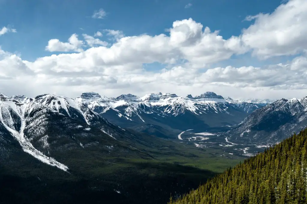
The best thing about driving to Banff is that the journey is in itself a vacation. Before you even reach your hotel, you will have seen some of the most naturally beautiful views in the world. The temptation to stop the car and get out for a walk sometimes is just too great. With this in mind, we have compiled a list of some of the best drives and walks there are to be found in the Canadian Rockies.
Table of Contents
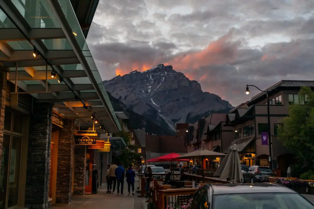
Around the Town of Banff
The Cave and Basin Centennial Centre
Built around two hot springs, visitors can walk through a tunnel to discover the hot spring in the cave and travel back to Edwardian times by strolling around the Basin hot springs and bathhouse. At the centre, which is the birthplace of Banff National Park, there are also year-round exhibits, films, and interpretive trails. Benches and picnic tables are located around the centre.
The Banff Park Museum
This natural history museum built in 1903, houses a fascinating collection of animals, birds, fish, insects, and curiosities found in the park. It’s one place where you can be sure of seeing wildlife. The museum is open year-round. Museum staff are happy to answer questions.
The Upper Hot Springs
The perfect spot for visitors to relax and enjoy themselves anytime of the year in the 38oC water of an outdoor soaking pool. It is also possible to get a massage. At an elevation of 1600 m, this is the highest and hottest of the five springs on Sulphur Mountain. It is 4.2 km by road from downtown Banff.
Near the hot springs, a gondola carries visitors to the top of Sulphur Mountain to enjoy a panoramic view of the area where it’s possible to go on a short hike, have a snack or meal in the restaurant, or picnic outside.
Bow Falls: Golf Course Drive
Bow Falls is formed by the Bow River flowing over the limestone bedrock between Mount Rundle and Tunnel Mountain. To feel the spray from the falls and hear its roar be sure to get out of the car. The Spray River flows into the Bow at this point. The golf course drive, about 11 km, starts and finishes at the bridge over the Spray River by the falls. This narrow, low-speed road takes you past the Banff Springs golf course and around a loop road at the far end. It’s a peaceful drive with good views and the chance of seeing elk.
Tunnel Mountain Drive
To really enjoy this trip you are urged to get out of the car at the viewpoints along the way. From its start at the intersection of Banff Avenue and Buffalo Street, this 9 km drive takes you to a viewpoint overlooking Bow Falls and the Banff Springs Hotel, up the side of Tunnel Mountain with views over the Bow Valley, then on to Tunnel Mountain Road. Turn right at Tunnel Mountain Road to enjoy viewpoints of Mount Rundle, the Bow Valley and the Hoodoos. Trails lead from these viewpoints back to Bow Falls. The road continues on to join the main road into Banff.
Vermilion Lakes Drive
Take along your camera and binoculars as the chance of seeing beaver, muskrat, bighorn sheep, Canada geese, bald eagles, osprey and other wildlife is good especially in spring and fall. The drive branches off Mount Norquay Drive just before the Norquay overpass on the Trans-Canada Highway. It travels beside the Vermilion Lakes for 4.5 km. Drive slowly and carefully as the area is popular with nature enthusiasts, photographers, joggers and cyclists.
Mount Norquay Drive
Visitors get a superb view of the town of Banff and the surrounding area from the viewpoint near the top of this twisting 6.4 km road. Bighorn sheep and mule deer are common sights. Day-hiking trails to Stoney Squaw Summit and Cascade Amphitheatre start at the top end of the road.
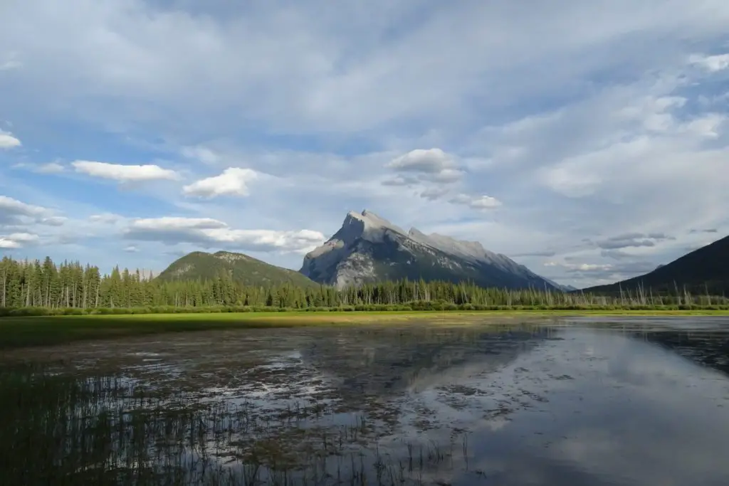
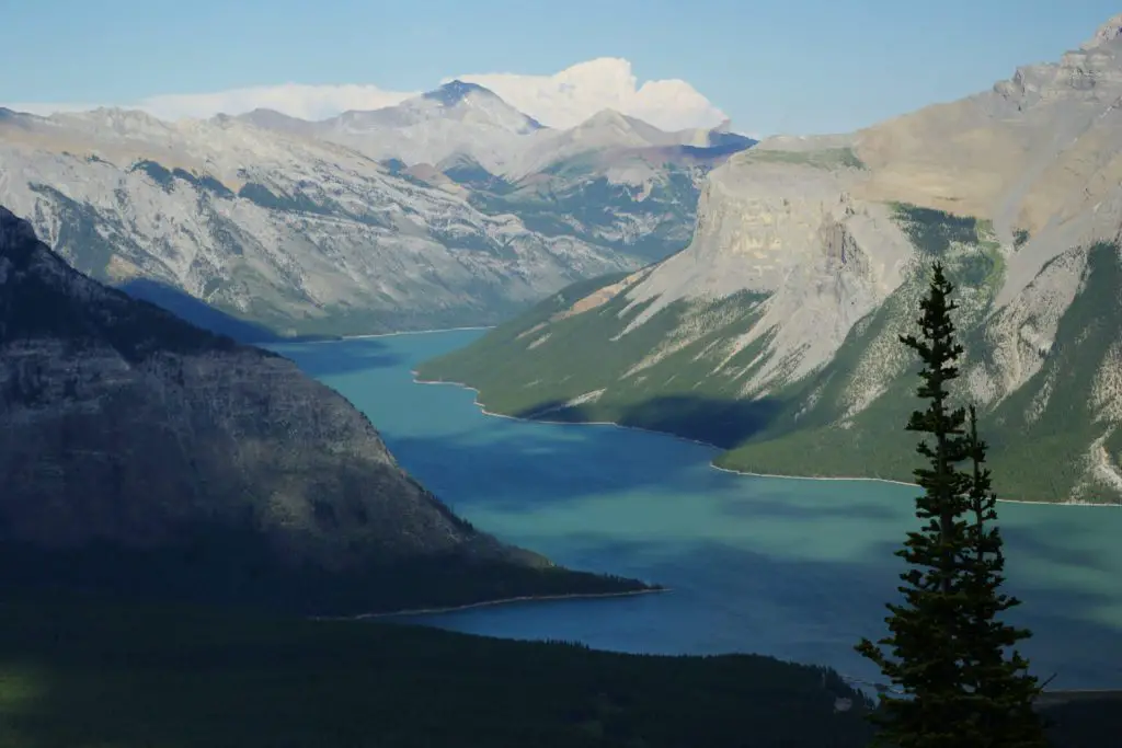
Minnewanka Loop: Johnson Lake
The loop road starts at the interchange on the Trans-Canada Highway northeast of Banff. The narrow, winding road takes you to the following popular places: Cascade Ponds, a day-use picnic area beside a large pond which may be warm enough to swim in; Lower Bankhead, site of an abandoned coal mine and plant, now interpreted by signed trails and exhibits; Upper Bankhead, site of the old coal mining community, now a day-use area with a shelter and picnic tables in an open meadow; Lake Minnewanka, the largest lake in the park and popular for boating, fishing, sailing, picnicking, hiking and camping. Rental boats are available along with fishing tackle for a day out on this 19.7 km-long lake. From Minnewanka, the loop continues on to Two Jack Lake, a sheltered lake with facilities for picnickers. Further on a road branching off the loop runs to Johnson Lake, another day-use area centered on a shallow lake ringed with trails. Picnickers, hikers, sunbathers, fishermen, and swimmers congregate here during the summer.
The Sunshine Road
The Sunshine Road starts at an overpass on the Trans-Canada Highway 9 km west of Banff and takes you 9 km up and into the mountains on a paved road. Bighorn sheep frequent the roadside. You can admire Healy Creek at a pull-off near the start or take a close look at avalanche slide paths higher up. At the end of the Sunshine Road, visitors can hike or bicycle 5.3 km up to an alpine meadow at 2280 m elevation which they can explore on a network of short loop trails. Bicycles and horses are not allowed on the meadow trails.
The Bow Valley Parkway
A low-speed scenic drive (formerly the 1A Highway) between Banff and Lake Louise on the opposite side of the Bow River from the Trans-Canada Highway. The parkway starts at an intersection on the Trans-Canada Highway 5.5 km west of the Norquay overpass. Located along the parkway are Hillsdale Meadows, Johnston Canyon, Castle Mountain, Baker Creek as well as numerous viewpoints and picnic sites.
Interpretive Trails and short walks
By taking a stroll on an interpretive trail you can learn about the park’s colourful human and natural history. These trails are short, well-built and easily accessible and will help visitors make their own discoveries when hiking other trails in the park.
Fenland Trail
The land through which this trail passes is slowly changing from marsh to forest. Beaver, muskrat, waterfowl and other birds are often seen. From the west side of Mount Norquay Drive you can get onto the trail at two points: one just beside the railway tracks and the other at the bridge in the picnic area. The Fenland Trail is popular with joggers, cyclists and as a route between town and the Vermilion Lakes. A brochure describing features of the 2 km trail is available.
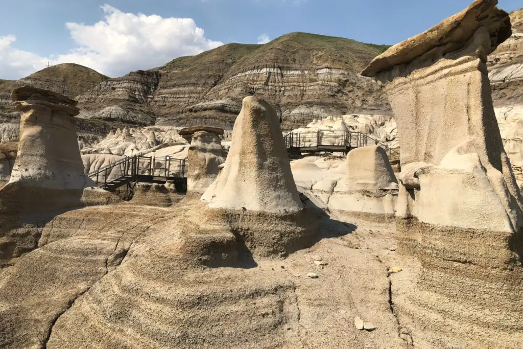
Tunnel Mountain Hoodoos
A short asphalt path that climbs gently past a number of viewpoints makes it easy for walkers to see these unusual formations and to learn some interesting facts about them. There are also superb views into The Bow Valley and across to Mount Rundle. This trail starts in the parking lot on the south side of Tunnel Mountain Road, east of Tunnel Mountain Campground. To experience more of this landscape, you can hike the Bow River/Hoodoos Trail which starts nearby.
The Discovery Trail
The 0.4 km Discovery Trail is a boardwalk built on the hillside above the Cave and Basin Centennial Centre. It takes you past the vent (the opening in the roof of the Cave) and to a spring flowing out of the hillside. Signs explain the geology and human history of the Cave and Basin. Benches along the trail allow you to relax and enjoy the views.
The 0.5 km Marsh Trail is another boardwalk. From it you will see the lush vegetation that thrives on the hot mineral water flowing down the hillside and get a bird’s eye view of the large marshes below. Along the boardwalk are benches, telescopes and signs telling of the natural history of this exotic area. On the marsh itself are a floating boardwalk and a bird blind for photographers and birdwatchers.
People in wheelchairs have limited access on both boardwalks, but bicycles are not allowed. A brochure gives more information on these trails and the Cave and Basin Centre.
Bankhead
This 1.1 k m loop trail starts in the parking lot on the east side of the Lake Minnewanka loop road 7.4 km from Banff. With the help of a descriptive brochure and interpretive signs you can explore the ruins and imagine the coal mine and briquette plant in full operation. There is a coal mine shuttle train and enormous coal tailing piles to see here. In the transformer building near the hillside, are displays telling of the work and social life of Bankhead. A hiking trails follows the abandoned Bankhead railway line south to Cascade pond, 2.5 km away. A few ruins of the ghost-town of Bankhead are located in the picnic area above the road.
The Park Interpretive Program
The park interpretive program offers a wide range of stimulating activities. Entertaining slide shows and talks are put on in the theatres in some campgrounds during the summer and at the Banff Information Centre and Cave and Basin year-round. Visitors can join an interpreter for a guided walk, or challenge them with questions about the park. During July and August, visitors can also take part in special events such as stargazing, talks by guest speakers, bicycle tours and film showings.
Information on the park interpretive program is broadcast on community cable vision, (Channel 10) and is published in The Official Banff National Park Visitor’s Guide, the park’s mini-newspaper, which is available free at park information centres.
Strolls and Walks
A stroll or short walk around Banff can be the start of an adventure. Walking is an excellent way of experiencing the park at your own pace, of pursuing such interests as photography, wildlife watching and fishing or enjoying yourself sightseeing and picnicking. As a away of getting to and from places walking is healthy, inexpensive and environmentally friendly. Listed below are some strolls and walks in or near the town of Banff.
Sundance Canyon Trail
This pleasant scenic trail starts behind the Cave and Basin Centennial Centre, an interesting place itself to visit. Formerly a road, its asphalt surface makes for comfortable strolling and bicycling. The trail runs for 3.7 km beside the Bow River, past swamps made by beavers and wetlands that are home to a variety of birds and animals. It ends at a picnic shelter at Sundance Canyon. A 2.1 km interpretive trail (closed to bikes) leads up the canyon and then loops back through the forest to its starting point.
Marsh Loop
There are beaver dams and lodges to see, a variety of birds to watch and hear and pleasant views from this wide trail around marshes below the Cave and Basin. This 2.7 km loop turns off the Sundance trail where it first meets the Bow River and then runs downstream between the river and the marshes. You can also get onto this loop from the Marsh Boardwalk, the Cave and Basin parking lot or the recreation grounds. The stables on the Recreation Grounds offer guided horseback trips on the Marsh, Sun dance and other nearby trails.
Bow River: Hoodoos
This 4.8 km trail will make you feel miles away from the town’s hustle and bustle. From the Bow Falls overlook on Tunnel Mountain Drive, this trail takes you under sheer cliffs on Tunnel Mountain (watch for climbers) through meadows and forests beside the Bow River and up a hillside covered with lodgepole pine and Douglas fir to Tunnel Mountain Road. From there a trail beside the road leads on to the Hoodoos.
Johnson Lake: Anthracite
Natural marvels, historic sites and a variety of birds and other small wildlife can be seen during a few hours stroll at Johnson Lake. Starting at the parking lot picnic area, the Johnson Lake trail encircles the lake in 3.5 km, never far from its shores. It crosses a causeway at the far end of this man-made lake and finishes following a power line clearing to a second lakeshore picnic site.
The Anthracite trails starts at the foot-bridge over the lake outlet. From there the trail runs downhill, over coal tailing piles and a grassy meadow (once the site of the Anthracite coal mines and later the Sun Chinese greenhouses) and, after crossing a footbridge, travels underneath towering hoodoos before doubling back on the cliff tops above them, with panoramic mountain views, to finally finish where it started. All that in only 4.4 kms! The cross-country ski trails, marked by square yellow signs are probably best left for bicyclists and horse riders to explore.
“C-level” Cirque
Part way up this trail, concrete walls, fenced-off vent shafts and a tailing pile are all that remains of the coal mine at level “C”. At the top, a jumble of rock at the base of a dished-in slope, the cirque, are all that remains of a glacier. The tailing pile and the jumbled rock, home to picas, make good viewpoints on this 3.9 km long and 450 m uphill trail which starts in Upper Bankhead parking lot off the Lake Minnewanka Road.
Upper Hot Springs
You can walk to the Upper Hot Springs on a trail that is shorter than the road and avoids a lot of traffic. The trail starts on a horse path located between the Banff Springs Hotel parkade and the Spray trailhead kiosk. There are straightforward and scenic ways of getting to this point, 2 km from downtown Banff, depending on whether you decide to walk directly up Spray Avenue or make your way by a series of trails along the Bow River, past Bow Falls and around the top of the golf course driving range. Once there, turn onto the horse trail and almost immediately turn left and you are only 1.8 km from the Hot Springs. The trail switchbacks uphill, follows a power line clearing and then emerges on Mountain Avenue. You can smell the springs 300 metres away.
Tunnel Mountain
Any reasonably fit person can climb at least one mountain in the Rockies by hiking this well-maintained trail. Bicycling this trail is not allowed. From the hiking sign on St. Julien Road, this trail climbs steadily, crosses Tunnel Mountain Drive and switch-backs to the summit in 2.3 km. At 300 m above Banff Avenue you get unobstructed views of the entire town, the golf course, Vermilion Lakes and the surrounding peaks including Mount Rundle. Deer are frequently seen from this trail.
Stoney Squaw
The trail to the summit of Stoney Squaw, Tunnel Mountain’s twin, starts near the entrance to the main Norquay ski area parking lot. It is a narrow 2.3 km trail most of the way through thick forest. On the way, views of the town and the Vermilion Lakes to the south are offered. From the summit, less than 200 m above the parking lot, you can see Cascade Mountain, Lake Minnewanka, the buffalo paddock and the Bow Valley to the south. This is a good spot to use binoculars.
Cascade Ponds
This open area around a large man-made pond with islands is a fine place to spend a lazy summer afternoon. To get there, turn off the Lake Minnewanka Road onto the first gravel road north of the Trans-Canada overpass. Picnic tables, fireboxes and shelters are located here and a short trail encircles the pond. A 2.5 km trail runs north to join the Bankhead Interpretive Trail. A short, steep trail climbs the hill behind the ponds to a viewpoint at the powerline and continues on to Johnson Lake. Cascade Mountain is visible everywhere.
Day Hikes
A day hike is any hike long enough to require taking a pack with a lunch and extra clothing, not to mention cameras, binoculars, guidebooks and maps. There is always plenty to see on any day hike while getting fresh air and exercise. Only a few day hikes in the Banff area are described here. For more complete information on day hikes, a hiking trail guidebook and topographical maps should be consulted.
Spray River Loop
The Spray River can always be seen or heard nearby and for many, including fishermen, bicyclists, photographers and even joggers, that is the charm. On either side of the river are old roads (now closed to vehicles) that this pleasant trail follows. The trail starts in the gravel parking lot behind the Banff Springs Hotel parkade. It crosses the Spray River 5.5 km upstream on an arched footbridge and ends on the Golf Course. From there you can walk into town or make your way by road and trail back to the hotel.
Sulphur Mountain Summit
Criss-crossing underneath the gondola on Sulphur Mountain, a well-defined and well-maintained 5.3 km trail climbs from the Hot Springs parking lot to the summit 670 m higher. Together the trail and the gondola offer options for getting up and down but check the gondola schedule if planning to ride it down. A restaurant and cafeteria are located at the summit along with a viewing platform, picnic tables and interesting interpretive signs. A herd of mountain sheep is often found in the area. Please remember that enticing or feeding them is illegal, and so is bicycling this trail.
A wide trail leads along the top of the peak past the concrete foundation of the Cosmic Ray Station and on to the turn-of-the-century weather observatory on Sanson Peak with breath-taking views of the valley and surrounding mountains. The old Cosmic Ray Station road on which bicycles are permitted drops down the back of the mountain to join the Sun dance Trail. At 2270 m, Sulphur is the highest mountain in the Banff area with a fairly tough hiking trail to the summit. Even on a sunny day a sweater or windbreaker may be necessary.
Bourgeau Lake
This trail will give you more than a taste of the mountain environment. Like most mountain trails it is a strenuous climb through a succession of forest types on the way in and a speedy downhill walk coming out. The trail starts at the parking lot on the south side of the Trans-Canada Highway 11.8 km west of the Norquay overpass and ends 7.4 km later and 750 m higher at a large alpine lake. On the mountains above the lake, depending on the time of year, you may see or hear rock and snow avalanches, watch waterfalls or spot mountain goats.
Cascade Amphitheatre
Enormous rounded gouges made by vanished glaciers high on the sides of mountains are common in the Rockies. This well-travelled 7 km trail takes you to one such cirque on Cascade Mountain. Start at the Norquay parking lot and hike across the ski area. Just beyond and slightly downhill of the last chairlift, trial signs mark the point where the trail enters the forest. Continue downhill to a bridge over Forty-Mile Creek with good views all around. The Amphitheatre is 625 m higher than this bridge and the parking lot only 127 m. At a junction 1.2 km past the bridge take the trail on the right. It switchbacks steeply uphill to a lovely alpine meadow in the basin of the amphitheatre where you can have lunch or rest while taking in the views.
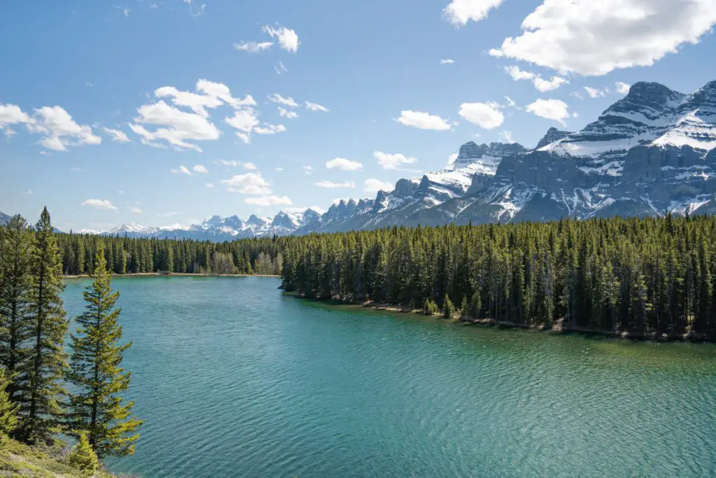
Lake Minnewanka
You can spend a relaxing day on this trail, strolling or biking down the lake as far as you have time to go, enjoying a picnic lunch while watching birds and boats, scanning the surrounding mountains for sheep and goats or trying your luck fishing. The trail starts past the boat docks and picnic area at a trailhead information kiosk. Do not feed any sheep or other animals; it can start a chain of problems for animals and humans. Not far from the kiosk you cross the gorge of Stewart Canyon on a massive wooden truss bridge. On the other side of the bridge, a narrow side trail wanders up Stewart Canyon while the main trail swings left and then with-backs uphill through trees before breaking out in the open and continuing on down the lake. This, the largest lake in the park, created by nature and man, serves many recreational needs but is, more importantly, the centre of life for numerous species of birds, fish and animals.
Safety
Taking a few precautions will help make a visit to the park safe and pleasant. On park highways please observe posted speed limits and drive defensively as many people are using the highways for sightseeing. Road conditions can be treacherous during storms and in winter.
Don’t let the mountain landscape tempt you into daredevil acts. Standing at the edges of cliffs or waterfalls, going mountain climbing on a whim, attempting to feed a bear, or stopping in the middle of the road to take a photograph are all dangerous.
If you are planning an activity in the which you feel there is an element of risk you may register at a warden office or information centre in the park. If you do make use of this voluntary registration system you must register out at the end of the trip in person or by phone.
The Warden Service coordinates emergency medical and rescue services in the park. If an accident does occur, contact the Banff Warden Office emergency number — 762-4506 (24 hours a day). Emergency vehicles operate out of Banff. A hospital and medical and dental clinics are located in the Town of Banff. A medical clinic is located in Lake Louise.
In case of Emergency contact the Banff Warden Office: 762-4506 (24 hour service).
Where to Get More Information
In the Park
Banff Visitor Centre
Tel: 403-762-1550
224 Banff Avenue, Banff
June 1 – June 20, 8 a.m. – 6 p.m. daily
June 21 – Sept 6, 8 a.m. – 8 p.m. daily
Sept 7 – Sept 26, 8 a.m. – 6 p.m. daily
Sept 27 – May 31, 9 a.m. – 5 p.m. daily
Lake Louise Visitor Centre
Tel: 403-522-3833
Samson Mall, Lake Louise
Same hours as Banff Visitor Centre
Banff Warden Office
Tel: 762-1470
Open year-round 8 a.m. – 4:30 p.m. daily
Lake Louise Warden Office
Tel: 522-3866
By Mail:
The Superintendent
Banff National Park
P.O. Box 900
Banff, Alberta, Canada T0L 0C0
Other Information Outlets
The Banff/Lake Louise Chamber of Commerce (403-762-8421) distributes information on businesses and commercial establishments in the park. It has an outlet in the Park’s Banff Visitor Centre. The Alberta Motor Association (403-762-2266) has an office in Banff on Bear Street. The Banff Public Library (403-762-2661) is opposite the Post Office.